Troy Kimmel
UT University / Incident Response Meteorologist
Member, Campus Safety and Security Committee
Senior Lecturer, Department of Geography and the Environment
tkimmel@utexas.edu
Severe Weather Alerts
Visit NWS Tweets
During the UT winter holiday break, please check the latest NWS Austin-San Antonio
forecast for metro Austin and The University of Texas at THIS LINK.
Courtesy of WeatherStem, you can see the latest CURRENT University of Texas
weather conditions and see the live camera at THIS LINK.
In times of severe and/or inclement weather, you can follow the latest area
watch, advisory and warning updates from our local NWS Austin-San Antonio
office through their WEBSITE.. or by reading the actual text products (always
the most recent at the top of the page) through THIS LINK which is courtesy of
the Iowa Environmental Mesonet. Always check the date and time of issuance
of these NWS text products since, in periods of tranquil weather, the latest
products may be outdated and/or expired.
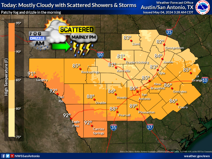
Today's Forecast
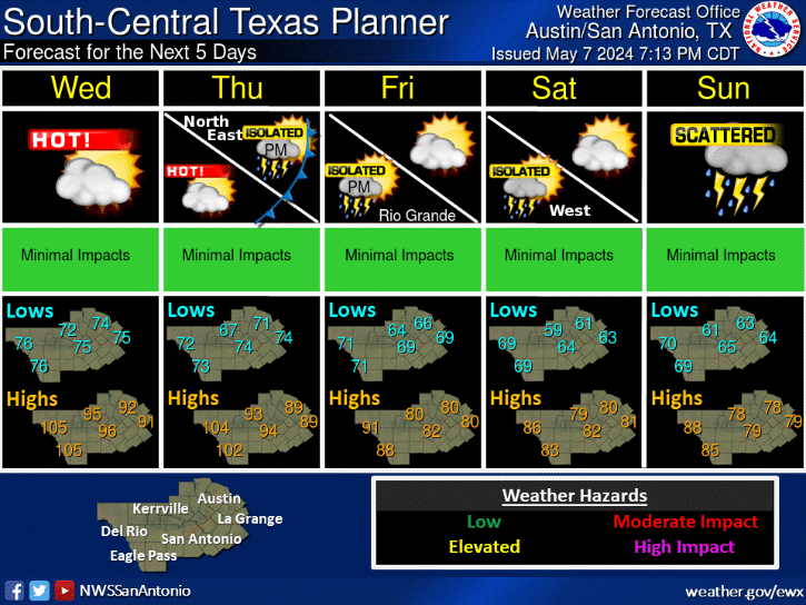
Five Day Planner